
 (3 votes, average: 5.00 out of 5)
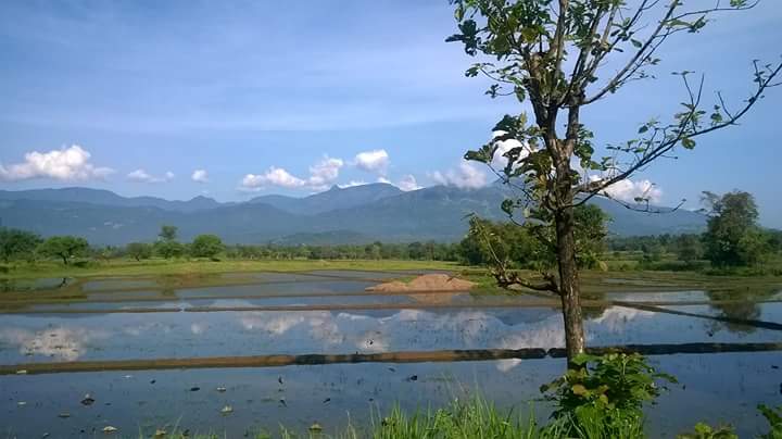
Ruins of part of an ancient Buddhist monastery lie in the area known as Nawamedagama in Dehiaththakandiya. The whole area is now a large paddy field and the only remains are a few stone pillars in the middle of this field which was declared a protected archaeological monument by the Gazette issued on 10th October 2014, and describes the location as follows ;
“Site of ruins with stone pillars at the place of (Latitude 07º 34′ 07.6” N and longitude 081º 01′ 15.1” E) in paddy land No. 148, Nawamedagama situated in Grama Niladhari Division No. 142/B, Nawamedagama in the Divisional Secretary’s Division Dehiaththakandiya in Ampara District in Eastern Province.”
Also See
Map of Dehiattakandiya Nawamedagama Archaeological Site
The map above also shows other places of interest within a approximately 20 km radius of the current site. Click on any of the markers and the info box to take you to information of these sites
Zoom out the map to see more surrounding locations using the mouse scroll wheel or map controls.
Travel Directions to Dehiattakandiya Nawamedagama Archaeological Site
| Route from Mahiyanganaya to Nawamedagama Archaeological Site |
| Through : Girandurukotte Distance : 30 km Travel time : 45 minutes. Time to spent : 15 mins Driving directions : see on google map |
0-09 m (89) 10-19 m (77) 20-29 m (47) 30-39 m (50) 40-49 m (25) 50-99 m (50) Ambalama (176) Ancient Anicuts (35) Articles (0) Asanaghara (8) Ashtapala Bodhi (5) Attraction Articles (3) Attractions (266) Beaches (10) Biosphere Reserves (3) Botanical Gardens (5) Bridges (35) Cave Art (13) Caving (7) Churches (30) Cities (9) Destinations (18) Dethis Pala Bodhi (27) Devalaya (51) Events (3) Flora and Fauna (82) Forts (52) Heritage (1953) Heritage Articles (27) Historic Events (7) History (7) Hot Springs (9) Hydro Heritage (105) Irrigation Articles (4) Islands (15) Kings of Sri Lanka (188) Kovils (29) Kuludage (11) Lighthouses (29) Memorials (57) Mile Posts (6) Misc (1) Mosques (4) Museums (15) National Parks (24) over 100 m (20) Pabbatha Vihara (13) Padhanagara (27) Personalities (211) Pillar/Slab Inscriptions (48) Popular Tourist Attractions (231) Pre Historic Burial Sites (23) Prehistory (45) Prehistory Articles (2) RAMSAR sites (6) Ravana (16) Reservoirs (73) Rock Inscriptions (36) Ruins in Wilpattu (11) Ruins in Yala (25) Santuaries (7) Sluice Gates (17) Stone Bridges (18) Strict Nature Reserves (3) Sumaithangi (3) Survey Towers (18) Tampita Vihara (242) Travel (5) View Points (24) Walawwa (13) War Memorials (26) Waterfalls (380) Wildlife Articles (28) Yathuru Pokuna (4)
Abhayagiri Monastery (20) Ampara District (196) Anuradhapura District (240) Badulla District (123) Batticaloa District (124) Colombo District (123) Galle District (76) Gampaha District (63) Hambantota District (124) Jaffna District (77) Kalutara District (53) Kandy District (217) Kegalle District (165) Kilinochchi District (13) Kingdom of Anuradhapura (88) Kingdom of Kandy (19) Kingdom of Kotte (9) Kingdom of Polonnaruwa (58) Kurunegala District (183) Maha Vihara (18) Mannar District (47) Mannar Island (10) Matale District (94) Matara District (53) Mihintale (22) Monaragala District (113) Mullaitivu District (39) Negombo (5) Nuwara Eliya District (126) Polonnaruwa District (138) Puttalam District (43) Ratnapura District (177) Trincomalee District (80) Vavuniya District (34) waterfalls in Sinharaja (3) z Delft 1 (5) z Jaffna 1 (20) z Jaffna 2 (26) z Jaffna 3 (14)